

We completed an Elevation Certificate in Woodburn last week to support the sale of a property and for Flood Insurance.
It worked out great with two Elevation Benchmarks marks within three blocks that fit together and one basically in front of the client’s property.
Thanks to The City of Woodburn and Marion County Surveyors for their Benchmarks and great documentation!
Only a few hours in the field before the rain and then some time to check off the required documentation.
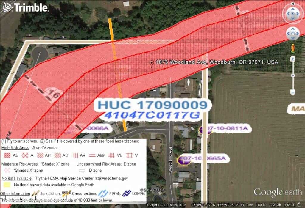
It is great how FEMA data can be presented on Google Earth!
Marion County also offers similar presentations.
Online resources are great!
Guess how the client found Ag Geospatial NW, LLC?
Online advertising per PLSO (Professional Land Surveyors of Oregon) (www.PLSO.org)
We are a Land Surveying and GIS company based out of Molalla, Oregon and cover the greater Willamette Valley!