

 Assemble Land Records for support of Loans, Rentals, Leases, Sales, Purchases, Estate Planning and more. Presenti ng different visuals to get a more rounded understanding of the Property in review. Putting facts together so that better decisions can be made.
Completely Electronic package delivery for cost savings and efficient sharing and storage of facts.
*Note data available can vary from locati on to locati on and will depend on what is reasonably and cost effective to obtain.
[button link=”https://aggeonw.com/services/land-packages/order-form/” color=”red” target=”_self” size=”small” title=”Get Started”]Get Started[/button]
[divider style=”dashed”]
Land Packages
Each Land Package includes a certain number of items to be included. When you order, you can custom the items you receive by selecting which ones you’d like to be included.
Land Package #1: $65
Any 6 items from Categories 1 thru 4
Land Package #2: $120
All items from Categories 1 thru 4
Land Package #3: $195
All items from Categories 1 thru 4 plus two items from Category 5
[button link=”https://aggeonw.com/services/land-packages/order-form/” color=”red” target=”_self” size=”small” title=”Get Started”]Get Started[/button]
[divider style=”dashed”]
Categories
Depending on which Land Package you select, you’ll be able to choose which items to include in your order. This list is subject to change.
Category 1: Parcel Details[raw][one_half][/raw]
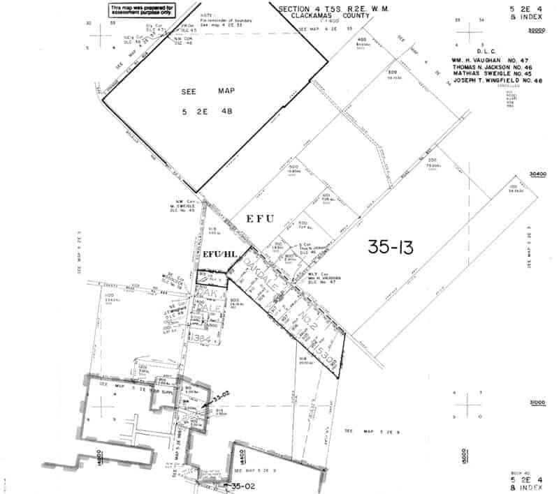
- Tax Map
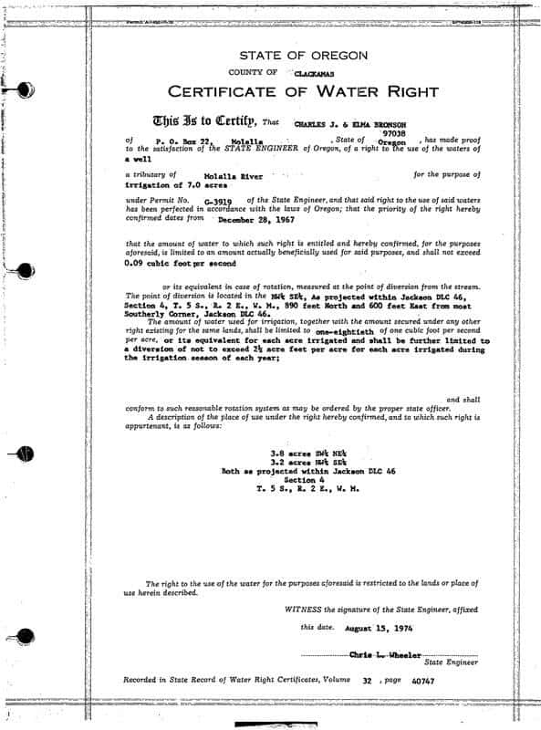
- Legal Description
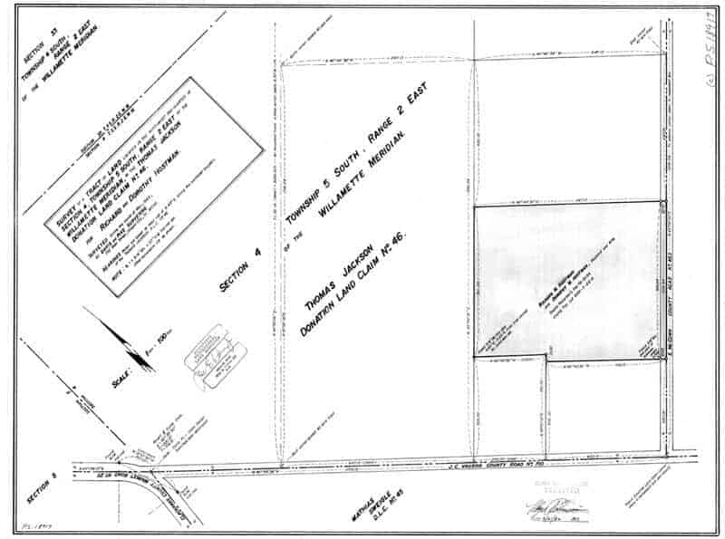
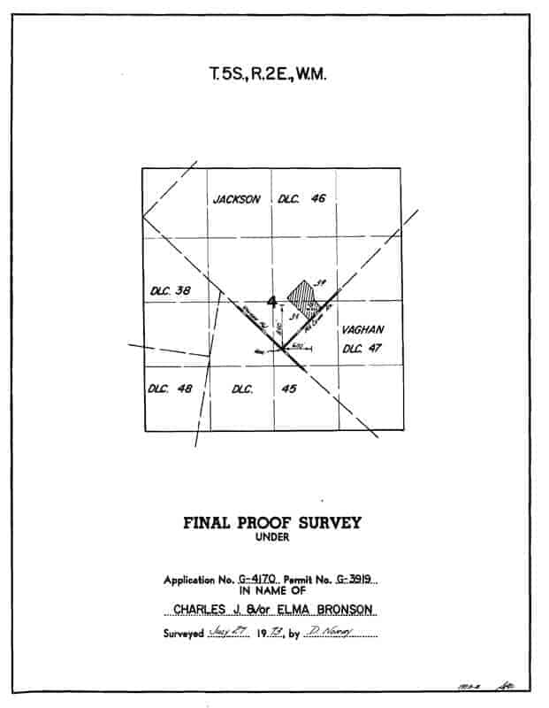
- Surveys of Record
[raw][/one_half][one_half last][/raw]
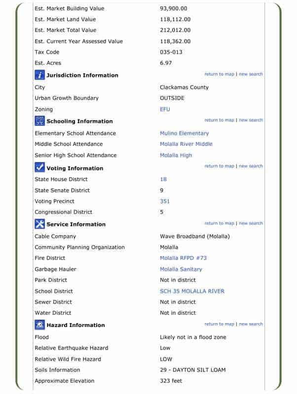
- County Parcel Details
- Local Community Services
[raw][/one_half][clear][/raw]
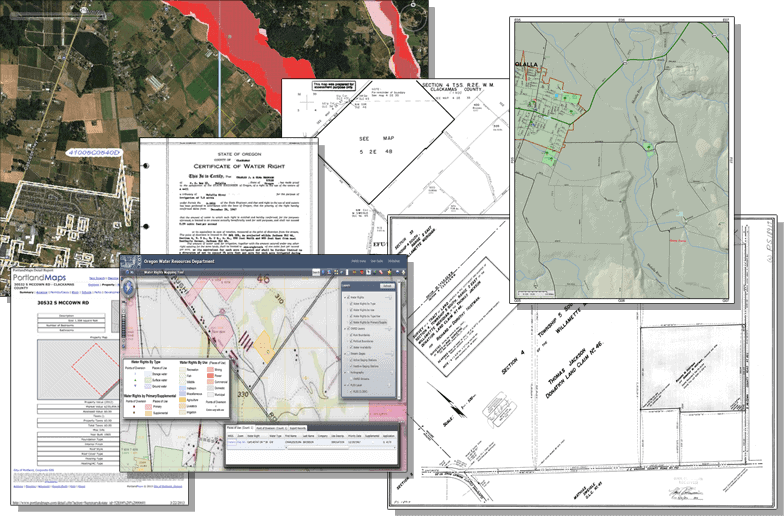
Examples
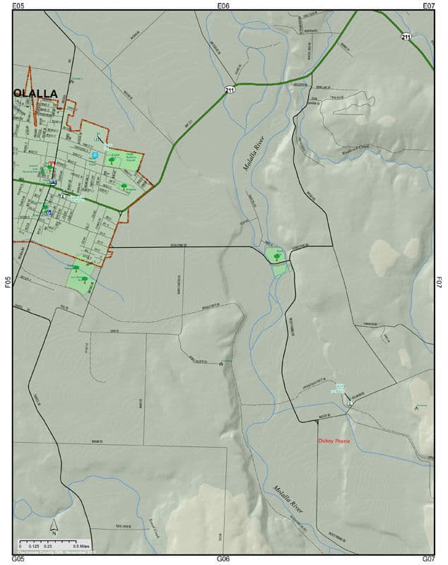
Category 2: Land Details[raw][one_half][/raw]
- Soils
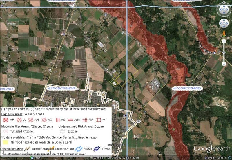
- FEMA Flood Map Overlay
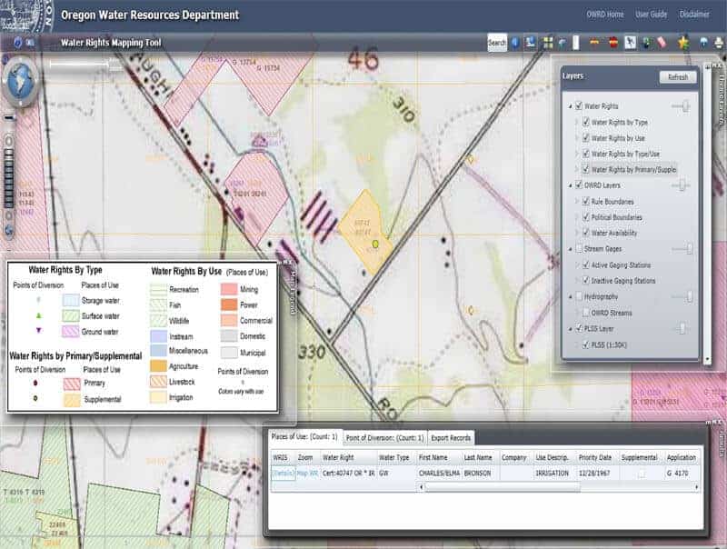
- Water Rights
[raw][/one_half][one_half last][/raw]
- Land Cover
- Zoning
- Zip Codes
[raw][/one_half][clear][/raw]
Examples

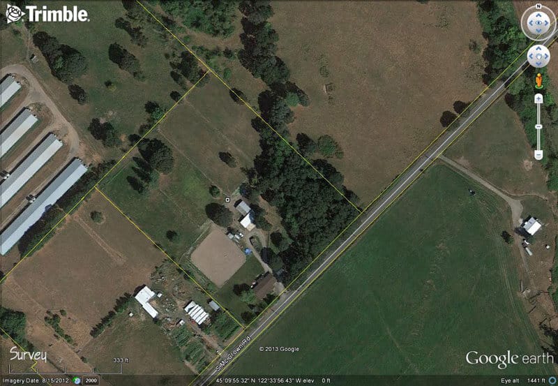
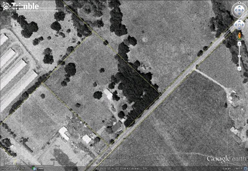
Category 3: Aerial Photo Background[raw][one_half][/raw]
- Aerial Photo w/approx. Property Lines
- Historic Aerial Photos
[raw][/one_half][one_half last][/raw]
- Aerial Photo of Neighborhood
[raw][/one_half][clear][/raw]
Examples
Category 4: Misc. Additional[raw][one_half][/raw]
- Info on Google Earth Link
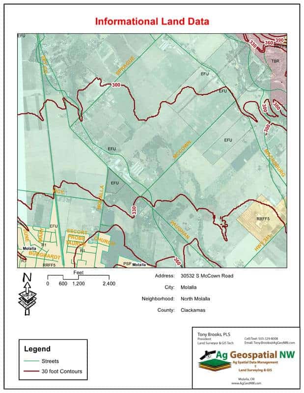
[raw][/one_half][one_half last] [/one_half][clear][/raw]Category 5: Terrain Details[raw][one_half][/raw]
- Contours
- Slopes
- Hillshade
[raw][/one_half][one_half last][/raw]
- Profiles
- Drainage
[raw][/one_half][clear][/raw]
Examples
[divider style=”dashed”]
Our online order form allows a simple, convenient way for you to place your order. Simply provide information about the subject property, your contact details, select a Package, then checkout with your credit card. Ready to get started? Click the button below to place your order.
[button link=”https://aggeonw.com/services/land-packages/order-form/” color=”red” target=”_self” size=”large” title=”Get Started”]Get Started[/button]